Friday, August 31, 2018

AT 101: backpacking the Carter-Moriah Ridge

heading up the Stony Brook Trail
My son told me a month before his 11th birthday that some day he is going to thru hike the Appalachian Trail. Understand that he had never before been backpacking. He had been told that I was once a backpacking guide. I'm not certain he believed that. But I took his new interest seriously. After all he was born and raised in the White Mountains. He has day hiked some of the tougher trails in New Hampshire. So backpacking the more remote stretches would be the next logical step. We formed a plan to do 2-3 overnight trips leading up to a 4 day backpacking route in August.

at the ridge on Day 1

We almost bit off more than we could chew this summer. My son is also focused on summitting the White Mountain 4000 foot peaks before his 13th birthday. Since we have plenty that are a short drive from our house, I picked a route that we get us out to the eastern most peaks, the Carter-Moriah & Wildcat Ridge. I made our daily mileage modest at 7-8 miles, but what the route may have lacked in length it made up for in ruggedness. Our first day was a gentle walk up the Stony Brook Trail to the Imp Shelter. My son's best friend came along with us so her family dropped us off at the trail head. This allowed me to leave my car at our end point in Pinkham Notch. After checking in with the caretaker and dropping our gear at the shelter we made a quick afternoon hike up to Mount Moriah to bag the peak.
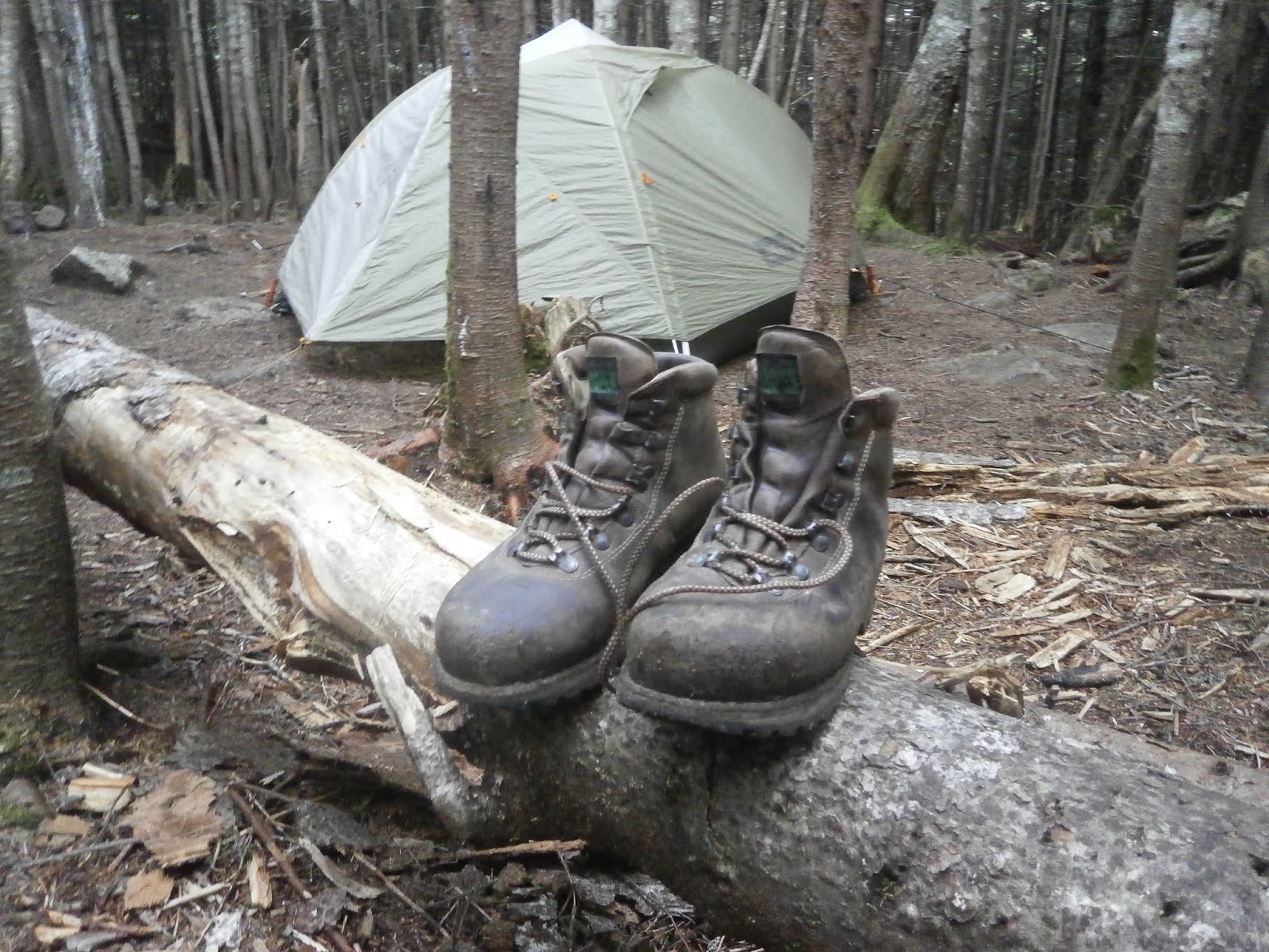
checking out the Imp Shelter

When we got back to the Imp shelter a half dozen thru hikers had also checked in for the night. The first thru hikers in were the grey hairs, the folks enjoying their retirement with a leisurely long walk on the AT. Don't misunderstand me, these are often some of the most experienced and entertaining hikers on the trail. But they often have a very different attitude than the 20 somethings who are racing to get the trail done in 3 months. Indeed through that evening every age and sort of thru hiker would check into the Imp Shelter. It was an education for my son to see the range of attitudes & equipment thru hikers bring to the Appalachian Trail. We joked with the retiree set as they called in hostel reservations on I-Phones before they turned in early. We chatted with the ultra light packing college kids as they laid out 1/2 size sleeping pads under trekking pole shelters. We woke up with 2 guys sleeping across the front of the shelter who had pulled in well after dark.

the Northern Presi's on a blue bird day
The next morning the older thru hikers made their coffee and were on the trail before the kids were awake. We made our oatmeal as the younger folks packed up. Since we were in no rush I took the time to chat with the 2 guys who came in last. They were a pair of south bounder's who had started the trail a month before, trail names Ox and Tiny T. My son had figured that he ought to hike south bound when he attempts the AT since he knows the White Mountains well. So he was eager to ask them about their hike. He asked them about the difficult trail sections in Maine, their time frame, their ankle gaiters, and water filter choices. Both of them were happy to entertain his questions. But the day was advancing so we shouldered our packs and headed up the trail.

The second day of a backpacking trip is always the hardest. Eagerness has been replaced by sore shoulders and hips. Novelty has transformed into the awareness that many miles of trail and meters of elevation gain lay ahead. We began the day with an immediate challenge, climbing the steep trail to North Carter. We climbed at a good enough pace to enjoy the morning glow on the Northern Presidentials at the summit. We took a snack break and headed on to Middle Carter, crossing paths several times with another South Bounder trail name Pace Maker. I said I hoped his trail name was not for hardware he carried in his chest. He laughed and said that it was because when he had 3 companions hiking with him he set the pace. He had started in Georgia but when his companions left the trail he chose to go to Maine and finish the AT hiking South. We hike past too many North Bound thru hikers that morning to count. Their lean legs, bushy beards, and trimmed down packs made it obvious that we were headed to Katahdin.

hiker's favorite lunch spot at the Carter Dome-AT trail juncture


After crossing Middle and South Carter we hiked down to Zeta Pass passing more thru hikers. Several were plugged into earbuds or listening to music streaming out loud. I suppose that helps make dozens of miles go by each day, but it's not the way I have ever hiked. We got to the juncture with the Carter Dome Trail just past noon. We stopped for lunch with over a dozen other hikers. It was like an AT open air cafeteria. Just after we found a spot to sit down Tiny T and Ox came striding down the trail. They asked my son if his pack felt light with a grin, then handed him his crocs. He had left them at the Imp shelter that morning. So my boy got to realize his first bit of trail magic.

just another Presi view
After finishing lunch I convinced the kids to go up Mt. Height. 20 minutes later I almost regretted my decision as we scaled the steep rocky section of that trail. The view of the full Presidential Range on a blue bird day however is a rare treat. But what goes up must come down. And the descent from Carter Dome to the hut is one endlessly steep down hike. We got to the hut tired & wrung out from the humidity. We filled up on water, checked the weather forecast, and chatted with the hut croo. A large group of teens had arrived at the hut earlier and a family was just about to check in. Seeing their fresh looking clothes & light packs reminded me how different hut hiking is from backpacking or thru hiking. So we cleared out to head down the Wildcat River trail to find our tent spot.
 

ready to tuck in for the night
We spent a quiet night at the least stealthy "stealth camp site" I've ever seen. But rather than impact a new spot I decided to use the well hardened one 30 feet off the trail. Sometimes low impact means using the already hardened areas instead of creating new ones. We hiked back up to the hut the next morning to fill up on water again. The weather report for Tuesday night and Wednesday was getting worse, high wind & heavy rain. Originally I planned to hike into Tuckerman Ravine for a day hike to Mt. Washington on Wednesday. But the weather forecast made that look like a very bad idea. By the time we climbed the Wildcats and were having lunch on the observation deck it was clear that the kids were tired. Where they had been skipping ahead of me on steep sections a day ago they were now plodding behind me. This confirmed my decision to cancel our Wednesday plan. But the route was not done yet, and the descent down the Wildcat Ridge Trail is one of the most demanding in the White Mountains. Slowly, carefully we picked our way down the boulders, slabs, & ladders.  It is the type of descent where each mile seems more like 5 especially on tired legs.
Looking back at the Carter Ridge from Wildcat A

We got back to Pinkham Notch late afternoon. We eagerly dug into the extra snacks I had left in the car for Wednesday's hike. 3 days of hard hiking had caught up with each of us. We spotted several thru hikers checking into the Joe Dodge Lodge including Pace Maker. I chatted with him about the last few days hiking. He told me how impressed he was with how the kids were taking to the trail. The kids themselves were happy with their hike. They poked through the gear and books in the visitors center, plotting their next adventure. I just hope I can keep up with them when they are leading the trips.
heading down from Wildcat D Mt. Washington in view


What has changed in the 20 years since I last backpacked the AT? Smart phone technology has altered the way hikers can negotiate the trail. The sight of folks making hostel reservations & researching the next trail section on their phones caught me by surprise. I could do without the streaming music some prefer while hiking, but to each their own sense of wilderness. The ultra light weight revolution has certainly made a big impact on thru hikers. I spotted more trail runners, stripped down packs & tarp tents than I remember ever seeing before. But most of AT hiking culture has not changed. It is still the social trail, the people you meet often define the hike. The log books are still paper & pen. The AMC shelters are still funky & crowded in August. Staying at them may be the best way to learn the ways of thru hiking. Frankly I wouldn't want it any other way.

Wednesday, August 15, 2018

It Ain't all Sunshine & Rainbows: A rainy day hike to the Osceola's

checking the trail map & notices at the kiosk
Committed outdoors folk accept poor weather as part of the life. Waiting for a perfect sunny day to get outside means waiting too long for most of us. The phrase among AT thru hikers is "you won't get to Maine if you don't walk in the rain". But trip leaders must keep an eye on the sky and have a flexible attitude. Younger & novice hikers may not have the physical or mental resources to enjoy a day out in drizzle. Day hikers can pick and choose more easily than thru hikers who are in it already. Still, one doesn't get to the top of 48 mountain peaks easily if you won't hike in the wet.

The forecast for this past Sunday was mixed, a slight chance of showers clearing to cloudy skies by mid morning. The reality was a bit more grim. Early morning rain subsided to drizzle, but it was still precipitation. We delayed our start to wait out the rain, but the weather did not cooperate. I checked and double checked that Nicholas still wanted to hike. He did. I dug out a set of size extra small gaiters from the barn. I found that my 15 year old Lowe Alpine gaiters had seen better days, the uppers were delaminating. Fortunately I had a spare set of gaiters, old guide habits die hard.

Gaitered up and ready for wet hiking
I decided to take the Osceola trail from Tripoli Road rather than start from the Kanc. I figured that a week of rain would make the Greely Pond Trail a swamp. We still expected to find mud and wet slabs on the higher trail. When we pulled into the trailhead parking at 11:45 a light rain was falling. Only one spot was left and several cars were parked on the road. This was the Waterville Valley "Denali Challenge" weekend, so plenty of folks were hiking despite the weather. A few soggy hikers were coming off the trail as we gathered our gear. I helped Nicholas fit his gaiters, I tightened up mine, and we headed up the trail at noon.

White Mountain hiking ain't smooth garden paths
The disadvantage of starting on a high trailhead in the White Mountains is the lack of "warm up". The Osceola trail is just that way, once over the packed gravel bridge across the brook the trail quickly goes into steep rocky terrain. Indeed the whole trail gets rockier until the top. Half an hour after starting our hike the rain stopped. Soon I was sweating in my jacket. I suggested to Nicholas that we take them off. Getting wet inside a rain shell is no way to stay warm or comfortable. Since low clouds & mist obscured the views we kept moving. The only break we took until the top of Osceola was for a quick lunch. The advantage of viewless day is that we talked about everything & nothing as we hiked at a steady clip.

top of Osceola without the view
down the slabs to East Osceola
When we reached the summit of Osceola the low clouds had yet to lift from the valley. The wonderful view of Waterville Valley and the Tripyramids was entirely covered. A group of 4-5 college age hikers were enjoying a sit down. They joked with us about the astounding views. After a snack on the fire tower pilings Nicholas & I continued to the next peak. The notorious section of this trail is the "chimney". It is a dicey scramble both directions. We took our time with the wet granite descent. In the middle of the traverse the trail was thick with mud puddles. We did our best to use the log bridges & stepping stones. But several hikers had walked on the edges of the trail which increases erosion. We stopped at the summit of East Osceola only long enough to enjoy a chocolate. I didn't even mention the view point knowing that it was fogged in. So we began the hike back out to Tripoli Road. After we passed the Osceola summit every trail section began to look the same. We were in a Ground Hog Day hike, where each quarter mile seems the same as the last quarter mile. 
sticking to the logs across the mud bogs


Up the Chimney back to Osceola

We made the miles go by continuing our conversation about Nicholas's choice of topics: Maglev trains, the Redwall series of books he is reading, and building tree houses. Eventually we reached the brook and sight of the trail head. Nicholas was happy to have mud on his gaiters and not on his pants or socks. I prepared a clean up kit just in case we did get sloppy and wanted to feel fresh before the ride home.
A body bucket for a clean ride home

Nicholas enjoyed his first marginal weather hike. I sometimes would rather hike on the foggy & cool days because then the crowds stay away from the trails. But this sort of weather requires some extra preparation. The old Swedish saying is "there is no bad weather, only poor clothing". While the right jacket, hat, boots, & gaiters make wet weather hiking possible, those things alone are not sufficient. One needs good judgement and a sunny attitude on any hike but especially when the sun is absent. Good chocolate at the summit helps too. Until the next blue bird day, happy hiking.

Thursday, August 9, 2018

Novice Lessons for Experts: a day hike to Whiteface & Passaconaway

"in the beginner's mind there are many possibilities, in the expert's there are few"
Zen Mind, Beginner's Mind - Shunryu Suzuki

My son has been hiking for as long as he can remember. His first true hike was Mt. Cardigan when he was 5 years old. We have not done many hard hikes though, certainly not compared to some outdoor oriented families. We've only gone out a few times each season since bike racing took up most of my weekends until now. This summer however he has fixated on peak bagging the 4000 footers. The demands of hiking all the high the routes in New Hampshire are still somewhat new to him. When he started researching thru hiking the AT this spring he did not initially believe that I was once a backpacking guide. But our many conversations & trips this summer have established my "trail cred" in his eyes.

1st view of Chocorua
I moved to New Hampshire over 20 years ago when I was leading wilderness trips. I sought to live in the White Mountains to ski, climb, & hike. I believed then that I would never grow tired of these hills. Yet after several hikes on the same trail one can become too familiar. For Nicholas almost every peak is a fresh wonder and every trip teaches multiple lessons. We should all try to learn the lessons that each hike offers every time out. But with experience one develops barriers to that awareness. We trade a novice's wonder for the assurances of recall & mastery.

Yet the beginners mind is a wonderful thing. It is not a blank page. It is not formless. The beginner's mind is that simple state of new excitement where all observation is fresh and accepted without prejudice. The expert's view can be limited by assumptions, habit, and past events. I get to experience these trails now with fresh eyes through my son's perspective. I loose that perspective when I rely too much on my expertise. Hiking in the present moment is no easy task, just like living in it.

cars parked to the road and then some

"well we know where we're going..."
Which brings me to the Mount Whiteface Passaconaway Loop. I last hiked these peaks 19 years ago, and wrongly assumed that they would be the same. My first realization of how my memory could fail me was driving to the Flat Iron Pond trail head instead of Ferncroft Road (oops). So we got a little later start than planned. The parking was lined out down the road by 9:30 a.m. but considering it was a fair weather mid summer day I was not too surprised. Nicholas practically skipped up Ferncroft Road for 1/2 a mile to the true trail head. His excitement for new peaks was not containable. We planned to hike the classic loop, up Blueberry Ledge to Mount Whiteface then across the Rollins Trail to Passaconaway and out the Dicey Mill trail.

On our way up Ferncroft Road

Since we started mid morning the heat and humidity rose as soon as we started hiking. I had forgotten how sheltered this loop is, barely peaking out from the trees on a few ledges. We were both drenched by the time we reached the first lookout view of Mt. Chocorua. I had also told Nicholas about the iron ladders up the steepest slab to Mount Whiteface. We had forgotten to bring the new guide book for the car ride to the trail so we did not know that the ladders are now gone. Nicholas scrambled up the slabs with the confidence of a billy goat. He waited patiently for me to follow at my own pace. We could see the holes were the ladders had been anchored, but no longer available for the climb. Although the parking was lined out, the trail itself never felt crowded. We crossed paths with plenty of other groups, but only enough to be company. On the top of Whiteface 7-8 other hikers were relaxing & enjoying the view of the lakes. Nicholas wanted to keep our pace going so we stopped just for a quick snack.


No ladders, No Problem
The past two weeks of rain meant plenty of mud on the trail. Descending the Rollins Trail we found slick boulders too. A wide variety of mushrooms are thriving in our summer monsoon season. Nicholas found a particular bright orange type his favorite. I also had forgotten how much descending the Rollins Trail does before crossing to the Passaconaway loop. We sat to check the topo map and have a snack near the bottom of the descent. We could hear the Wonalancet River below us rushing down the ravine.
Mt Chocorua from the Passaconaway Trail

The climb up to Mount Passaconaway has steep rocky sections in either direction. I decided to go clockwise since that gets the steeps done early. While I remembered that the "peak" of Passaconaway has no view, I thought there were more lookouts along the way. Now the trees have grown up enough that only a couple of views are apparent. We continued to drip sweat from the humidity. I encouraged Nicholas to drink more frequently and took a GU electrolyte cap. The heat and distance effected both of us. I slipped coming down a slick slab falling onto & cracking my favorite hiking stick. I bid so long to my dear red maple, 22 years of faithful service was as much as anyone could ask for.

coming down something like this is where I broke old red
We took our snack last break once we got to the juncture with the Dicey Mill Trail. Both of us were weary and eager to finish the hike. Yet I knew we had over 3 miles of descending trail ahead. Those miles went by quickly enough. We trotted down sections where the trail was smooth. A pair of trail runners passed us going double our speed, carrying nothing but water. 20 years ago I don't think I ever saw trail runners on these trails. But times and ambitions change. The new "bridge" across the Wonalancet is a simple birch log. We crossed it one at a time. I reminded Nicholas (and myself) to look where you want to step not where you want to avoid. By the time we got to Ferncroft Road we were both beat. We hike just over 11 miles in just under 6 hours. It was the longest day hike Nicholas has completed. We agreed that this accomplishment deserved an ice cream stop on the way home.

one last glowing mushroom on the Dicey Mill trail
What novice lessons did I take from this hike? 1) remember the guide book for the drive. Pay attention to what is apparent rather than what is expected about a trail. 2) Get to popular trail heads early in the summer 3) Choose routes based on the weather conditions, hikes in the trees are less fun in 80% humidity, just as hikes above tree line are poor choices in 50+ mph wind. 4) A week of wet weather is going to make trails slippery, especially damp granite slabs. Chose boots, socks, & gaiters with that in mind 5) Measure your pace; any hike in the Whites longer than 6 miles is going to take a toll eventually. Be aware of eating enough, drinking enough, and stepping carefully on tired legs.

I'm glad to share these lessons with my son. I hope to remember to learn new lessons on our next day out. I hope the same for you on your next adventure.


Wednesday, August 1, 2018

Turning Round Right: Pemigewasset Mountain Meandering

Looking north from Mt. Osceola
Mountains don't meander. They are fixed things in human eyes. Indeed people regularly orient themselves based on the position of mountain peaks, visible from many miles away. Mountains however do change. Those changes mostly happen over epochs, much longer spans than people have the attention to track. Occasional mountains will change quickly, such as when the Old Man in the Mountain fell some 15 years ago. I was here then, when the Great Stone Face, as Nathaniel Hawthorne called it, slid down Cannon Cliff. That was a sad day for everyone who loves the mountains of New Hampshire. It was a day we knew was coming eventually, but that few were truly prepared to see. Yet for most of the 100 million years the White Mountains have existed, change has come slowly.


The Old Man in the Mountain 2003
Rivers do meander. The Pemigewasset River is no different in that respect. Indeed steep terrain at the head of this river causes it to meander regularly through the valley. In the past few years heavy storms have forced the river to meander more often than not. While I do enjoy the occasional paddle on the Pemi this page is not about rivers, it is about traveling in the mountains. More than half the White Mountain 4000 foot peaks feed this river. Truly the head waters of the Pemigewasset River are the heart of the White Mountains. 

People do not meander either, but they do wander, and that is something like meandering. I moved to New Hampshire from Kansas to be in the mountains: to climb, to hike, to ski, and work where I loved to play. For my first few years living here that is exactly what occupied my energy. But 16 years ago a desk job turned my attention away from climbing and toward racing bikes. So I spent little time chasing peaks and more time chasing podiums since. Almost all my spare time and energy have been devoted to cycling since I returned to racing.


my son after backpacking over Mt. Mousilauke
But life travels in a long loop sometimes. My son is now 11 years old. While he likes biking, he is not enthralled with racing as I was at his age. He is captivated by mountains. On any given weekend he'd rather bag a 4000 footer than go to a bike race. He spent this spring researching the Appalachian Trail for his life goal of through hiking it someday. In the winter he'd rather back country ski than ride lifts. I'd be a fool not to indulge his passion, especially considering I was once a backpacking guide. Just discussing routes, gear choices, & technique with him has been delightful. Combine his interest with my lack of training this summer and cycling has moved to the back burner.

In a way returning to the mountains feels like coming home, although I never truly left. My house is still a quarter mile from the White Mountain National Forest border. My local friends have always been comprised of hikers, climbers, & skiers who came here for the same reasons I did. Simply my attention has been returned to what drew me here in the first place, being in the hills.


Lastly, there is a Mount Pemigewasset. It is a modest hill at the southern tip of Franconia Notch. It is an easy hike, only 2550 feet high, and easily overlooked by those seeking the higher peaks nearby. But it has a wonderful view of the Kinsman's and the Franconia Ridge. On a clear day one can see Mt. Tecumseh and Mousilauke too. It is also the first peak I hiked in New Hampshire, a few days after I arrived. While I may have wandered around New England in the 20+ years since, my heart has stayed in the mountains, dreaming of those peaks I first spied from Mt. Pemigewasset. 


on Mt. Mousilauke, my happy place
So expect that I will now devote my time and my writing to being here, in the high places of the White Mountains, and that makes me happy. I hope to share that happiness with you.